
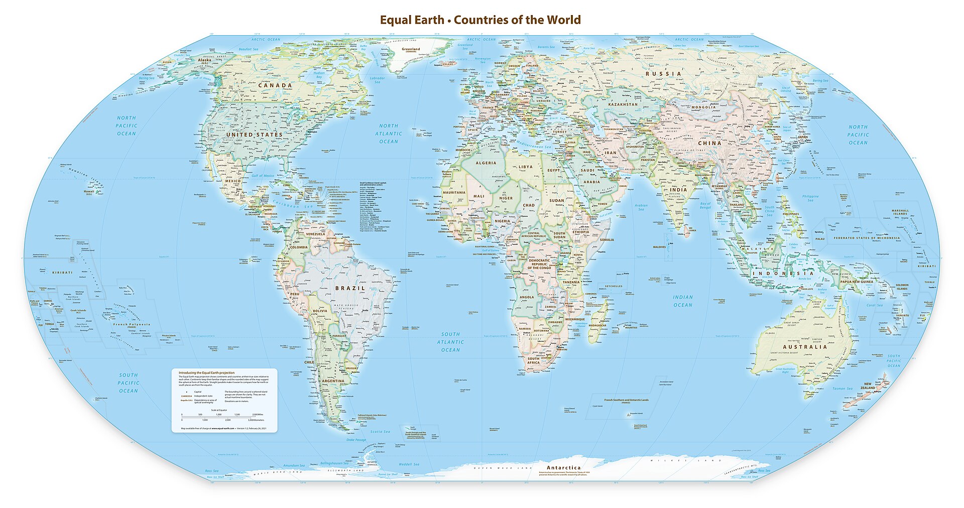
The United Nations General Assembly has overwhelmingly backed a resolution encouraging wider use of world maps that more accurately represent the relative size of Africa and other continents.
The resolution, led by Togo on behalf of African states and supported by the African Union, passed on Friday with 164 countries voting in favour. The United States cast the only vote against, while Estonia, Georgia, Lithuania, Moldova, Serbia and Ukraine abstained.
The measure promotes the use of the Equal Earth projection and other equal-area maps in education, government, international organisations, media and digital platforms.
It follows the African-led “Correct the Map” campaign, which argues that the centuries-old Mercator projection gives a misleading visual impression of the relative size of continents, particularly Africa.
The Mercator projection was created by Flemish cartographer Gerardus Mercator in 1569 for maritime navigation. Its design preserves directions and angles, which made it highly useful to sailors, but it increasingly exaggerates the apparent size of landmasses as they approach the poles.
As a result, Greenland can appear roughly comparable in size to Africa on a Mercator map even though Africa is about 14 times larger by land area. Europe and North America are similarly enlarged relative to regions closer to the Equator.
The Equal Earth projection, developed in 2018, takes a different approach by preserving the relative area of countries and continents while retaining recognisable shapes.
No flat representation of the globe can perfectly preserve area, shape, distance and direction at the same time. Equal Earth therefore does not eliminate every form of cartographic distortion, but it provides a much more accurate comparison of the relative land area of different parts of the world.
Togo’s Foreign Minister, Robert Dussey, argued before the vote that maps influence more than geographical understanding.
“Maps shape our understanding of the world,” he said, adding that they influence education, imagination and collective perceptions.
Supporters of the initiative say the widespread use of Mercator maps has contributed to a distorted perception of Africa’s geographic scale and global significance.
The United States opposed the resolution, arguing that the initiative reflected a broader ideological agenda and diverted the UN from more pressing international priorities. Washington was the only member state to vote against the measure.
The resolution is not legally binding and does not prohibit schools, governments, publishers or technology companies from continuing to use Mercator maps.
Instead, it encourages them to consider Equal Earth and other equal-area projections when accurate comparisons of geographical size are important, while also teaching users about the limitations inherent in representing a spherical Earth on a flat surface.
The vote represents a significant diplomatic success for the African-led campaign and could influence the way world maps are presented in classrooms, publications and digital services in the years ahead.